Showing posts with label geospatial technologies. Show all posts

Monday, March 14, 2011

Caching into Writing

Geocaching isn’t just for science class or the serious geography geek!  A cache is simply a hiding place, and caching is hiding something like a treasure.  Nature is full of treasures waiting to be explored.  A popular movement called “geocaching” gets folks outside with their GPS units to find treasures hidden by other geocachers.  If you haven’t tried it yet, it’s great fun! (www.geocaching.com)  Folks are geocaching all over the world!
Many educators are taking that idea to the classroom to do campus investigations.  Now you might expect that it’s the science teacher out looking at nature, but surprise your students in English Language Arts class with an outdoors writing assignment!  Realizing that not all classrooms are created equally, here are some low-tech options as well as the spiffy high-tech ones.  Either have students locate specific cached items or let them explore the landscape for surprises.  Anyway you do it, get creative and allow the students to explore their creativity.

Low-Tech
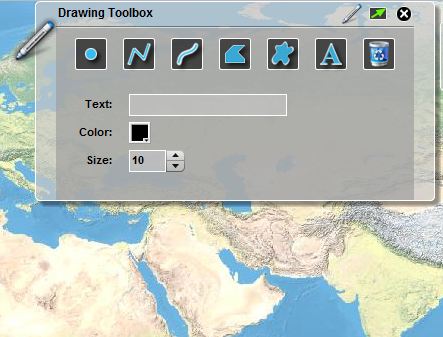
  • Create a map of your site with destinations.  Use a hand-drawn map with destinations or use a tool like Sketch-A-Map (http://edgis.org/sketch) to create your map for students.
  • Students can create a poem or story based on the destinations on the map.  Nature is an excellent way to pull more adjectives out of a student.  I used a similar activity with my students in my book, Reading, Writing and Thinking around the Globe: Geospatial Technologies for English Language Arts Classroom and Beyond (www.barbareeduke.com) where students create topographic and geographic definitions for words. Visualizing vocabulary can help cement those words into a student’s personal dictionary.

High-Tech
  • Using your school’s or a set of loaner GPS units (www.gisetc.com). Set up waypoints with caches.  Perhaps the students find words, phrases or starters for writing assignments.  They could take photos and return to the classroom with real experiences.  Don’t think that you have to have green spaces and trees to make this work.  Urban explorations could be quite powerful as well!  Perhaps tell the stories of graffiti or buildings changing over time.  
  • Perhaps you decide to pair the GPS units with cameras (a reason for kids to use those cell phones) to create a photo essay.  Just ask National Geographic if photos have a story to tell!
  • Another option is to use a smart phone application.  I have a GPS app on my iPhone (MotionX GPS) that integrates a picture and text with my waypoint.  I can email this waypoint with the photo and text attached, and then view it in a virtual globe application like ArcGIS Explorer (http://www.esri.com/arcgisexplorer) or Google Earth (http://earth.google.com), another educational reason for kids to use that cell phone at school. Because applications like ArcGIS Explorer are equipped with a simple presentation creator, as a next step, you could combine all the stories and photos for a class-wide virtual tour. 
  • For the more adventurous, you might like to check out a project called “confluencing” (www.confluence.org).  This calls for a GPS unit and some planning.  Check out some of my adventures with my friend, Dr. Joseph Kerski. (http://www.confluence.org/confluence.php?visitid=14853). The post-adventure writing is the star here.  You could take this same approach with your geocaching explorations as well, a detailed story of who, what, where, when, why and how is great practice for all those persuasive writing assignments!

The moral of the story here is: expand the borders of your classroom.  Think beyond the text book and computer screen.  Engage students with outdoor spatial experiences and watch their writing transform!

Tuesday, January 11, 2011

Q & A: Studying Louisiana Wetlands

It's a new year filled with new questions from my GIS teacher friends.  Solving questions and having students go on that quest is so powerful.


Question: I have a GIS student who is interested in learning some things about Louisiana’s water. She is interested in studying wetlands and salinity as a first topic choice. Erosion and river silt problems along the coast would be a 2nd choice.

Do any of these sound reasonable (because you can help us find data sources)? Do you have data sources that might lead her in some other directions?

Answer:  The fine folks of Louisiana have a DVD of state geospatial resources.  
I have a two DVD set from 2007.  It's now available for download at: http://lagic.lsu.edu/geodata/LOSCO/2007_DVD/default_2007DVD.htm.  They have a quick start guide to that data collection also: http://lagic.lsu.edu/geodata/LOSCO/2007_DVD/downloads/2007DVD_Quick_Start_v20071017.pdf

Some other sites that may be helpful:

Wednesday, August 25, 2010

GeoCool: Exploring with GeoTechnologies

New Article published in Learning and Leading with Technology with Joseph Kerski "Geo-Cool: Exploring with GeoTechnologies" p. 28-31 (September/October 2010-Vol.38 No. 2).  We've highlighted some examples of geospatial technologies for the classroom.  There's something for every classroom!

Monday, March 08, 2010

ASCD 2010 Report

I'm reminded of the Dr. Suess book, Oh the Places You'll Go!  Two
conferences in one weekend is where I went...driving to San Antonio
from GeoTech in Dallas.  After stopping by Baylor University, my alma
mater, to say hello to the bears (Yes, we have real bears in the bear
habitat on campus).  Shannon White and I headed on down to San Antonio
to meet up with Randy Kilian-Smith.  With the theme "Critical
Transformations" ASCD (www.ascd.org) offered a great opportunity to
inform folks on the possibilities with geospatial technologies. Linda
Mariotti, ASCD President, says "As relationships, systems, economics
and societies are being redesigned and refashioned in ways that
challenge the status quo, new dimensions of learning and teaching must
also be boldly envisioned.  Everyone with a stake in learning must be
engaged in better meeting the complex needs of 21st century
students."  Doesn't it make sense to put geospatial technologies in
this discussion?

We presented "Transforming Curriculum with Geospatial Technologies."
Geospatial technologies facilitate a learning environment for students
to discover the whys and hows of their curriculum, to engage multiple
intelligences, and to think spatially.  These technologies offer
unique opportunites to incorporate 21st century skills by expanding
the scope of curriculum to tap into cognitive research strategies
through studying local and global issues across all content areas.  We
shared research-based pedagogical approaches to classroom-tested
geospatial tools, ready-to-use resources, lesson plans, software
recommendations and experience.

It's always a challenge to include everything we need to say in 60
minutes!  But we gave it a go and enjoyed having our beloved leader,
Charlie Fitzpatrick, in the audience.  You can have a look at the
presentation online at http://www.barbareeduke.com/downloads/downloads.htm.
Special thanks to ESRI who provided us with books and GIS in education
materials for the participants and to the GeoTech Center for
sponsoring my travel needs.  We're looking forward to next year's
conference.  I encourage you all to get involved in local, state,
regional or national events where you can share your perspective on
being spatially aware and impacting students.