Sunday, August 09, 2015

42 ideas to include GIS in Education

 Fresh from our presentation at the Esri EdUC 2015 with a salute to Douglas Adams’ Hitchhiker’s Guide to the Galaxy, Shannon White and I present 42 ideas and resources that may help educators and geomentors in their quest to integrate GIS, GPS and geography into education, inside and outside.  


  1. bring a map of the school to examine and interpret
  2. map gallery (student made or professional made or both)
  3. Make a map with cookie dough and icing
  4. Draw a mental map from home to school
  5. Topographic bingo
  6. Bingo with a community based satellite image
  7. Show live maps of buses (real time).
  8. track the weather
  9. watch live earthquakes
  10. count time zones
  11. map the countries playing in world cup
  12. make a map of all the places in your books
  13. plan a route to the park
  14. hide and seek on campus with drawn maps and clues (transition to geocaching)
  15. track vocabulary words country of origin
  16. collect scientific discoveries by location
  17. solve math problems that give coordinates as answers
  18. brainstorm school or local problems that a map or location would help solve
  19. research a topic with map data only
  20. students find one cool map related fact and share it
  21. map the news for one day, then examine change over time
  22. where does your food come from (Thanksgiving arcgis maps as an example)
  23. where do your clothes come from (NatGeo gadget)
  24. build a map (NatGeo printables – MapMaker interactive)
  25. Map places you want to visit (or have visited)
  26. Look at change over time in your community (changematters.esri.com)
  27. examine story maps about a topic you are studying (i.e. the bat map)
  28. Track roadkill or trash or something else found along roads
  29. Map your school yard (transportation, recreation, natural features)
  30. look at old maps (David Rumsey Map Collection) and compare/contrast to digital maps
  31. Use John Snow Map in ArcGIS online to examine spatial analysis
  32. Show a brief video about GIS in use (Ushahidi, Geospatial Revolution, etc)
  33. Examine the Earth as Art collection and discuss geography and remote sensing patterns
  34. Participate in a crowdsourcing or citizen science effort (BioBlitz using iNaturalist, Project Budburst, Globe at Night)
  35. Make a smell or sound map of your neighborhood
  36. Plan a road trip or vacation for yourself or someone else
  37. make a story map or Snap2Map
  38. find cool map projects in the online map gallery – how many are problems in your area?
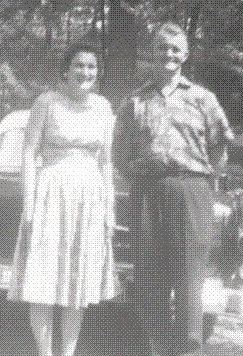
  39. Map your family or family history (watermelon story)
  40. Map your life or create an  autobiographical map
  41. Help map a local park or trail
  42. Find a geographic element that connects math, science, language arts and social studies

Wednesday, April 29, 2015

Watsons Go to Birmingham - A GIS Journey

 The story of a black family traveling from Flint, MI to Birmingham, AL in 1963 is the heart of this mapping experience for students.  They explore the journey, historic demographics, change over time, and take virtual field trip. 


Join the Watsons on a journey in the brown bomber, https://www.arcgis.com/apps/MapJournal/index.html?appid=0b83b10a4e9148fd80e3fad5300e3e05

Saturday, July 20, 2013

Common Core Reading & StoryMap

 I've tied the reading standards to story maps to give students an unique opportunity to engage with the standards.

There is one activity for each main standard.

  • Central Ideas
  • Compare Approaches
  • Read and Comprehend
  • Delineate and Evaluate
  • Developing Ideas
  • Inferences and Evidence
  • Integrate and Evaluate
  • Interpret and Analyze
  • Point of View and Purpose
  • Structure and Relationships

Download a zip file of all the activities

Wednesday, May 08, 2013

Interesting Facts: Authors, Words and Books

Thanks to a recent email from a friend who knows I love cool and quirky facts, I found yet more...cool and quirky facts from the fun folks at Mental Floss.  Some of these could be excellent fun as we approach the end of another school year.

Twain's Typewriter
Authors and Their Typewriters
I'm thinking this is a great way to talk about the creative process and the tools you use.  I still love writing ideas down in a small notebook, even though I'm a self-proclaimed techno-geek.
http://mentalfloss.com/article/21979/quick-10-10-authors-and-their-typewriters

Authors and DIDJAKNOW?
Now these are just fun things that make you say, "Hmmmm."
Thoreau....yoga master...REALLY?!?  Apparently, yes! http://mentalfloss.com/article/50408/henry-david-thoreau-yoga-master

Making Up Words? 
According to my students, I'm famous for this skill.  They named my language "Duke-ish." Ol' Sir Isaac Newton himself invented his own language.  That's not bad company! http://mentalfloss.com/article/50461/language-isaac-newton-invented

And if you want to be proper, here's a spelling and grammar video for you. http://mentalfloss.com/article/50485/38-common-spelling-and-grammar-errors

Spendy Volumes
Here's a stack of books that will cost a little more than those you find at the yard sale! http://mentalfloss.com/article/50220/8-rare-books-cost-fortune

Monday, April 01, 2013

The Great Watermelon Conundrum of 1978

 Summers were great fun in the deep south! Afternoon stiflingly sticky heat was often quenched with the timely arrival of the ice cream truck as you hear “The Entertainer” tune from far away…plenty of time to plead with Mom for 50 cents! Often those summers included family journeys to the lake house or our family farm. 


memapopie

My Popie, my Dad’s father, grew up doing quite a bit of farming on the family acreage in Branchville, AL. My brother, my cousin and I would often jump in the back of the truck and “help out,” especially at harvesting times. One summer Popie decided to let us help plant. He had done all the heavy lifting (plowing, fertilizing and such) and called us in for the fun stuff…seeds!


He always planted the usual suspects so that our winters were filled with my Mema’s canned beans, peas, okra, corn, tomatoes and such…included in the annual plantings were those delicious watermelons that were just the thing you needed after a day boating and swimming in the lake…cracked open on the porch like manna from Heaven. A little shade, a breeze and sweet watermelon still makes me smile.


Okay so the process was simple. He gave each of us a row and a small handful of seeds (dozen or so). We each looked at the paltry pile and said, “Popie, this is not enough seeds! Can we please have more? We want to have plenty of watermelons.”

He replied, “Oh, now, that’s plenty of seeds.”

“But Popie….”

“Well, okay, but if you plant ’em, you’ve got to pick ’em!”

“Oh YES! No problem, Popie! We’ll pick ’em!”


So with that we scampered into the field to plant our personal crop of melons. As the time goes by we look at the plants grow…and grow….and grow. Seems that we had the perfect mix of rain and sun that year for a bumper crop! Before we knew it, it was time to pick melons! We hauled in melons all day and enjoyed the bounty on the porch along with a few neighbors and friends. (By the way did you know standard melons weigh about 20 pounds each?) We were so proud! Another bit of time goes by and Popie calls, “We need to go to the farm. More melons!” 


Excitedly we go haul in another bounty! Now this was fun the first two trips but after that…not so much. By the time the season was done we must have filled his pickup truck three times with watermelons. We couldn’t give them away, we had so many! 


Lesson learned!!! Needless to say, we didn’t volunteer for watermelon duty the next summer!


blairfarmrd

The story brings home some personal geography and understanding crops. Geography, math and spatial awareness are key to really understanding the watermelon conundrum. If you have a row that is 100 yards and you plant the entire row six inches per plant, how many plants will you have? Given the standard yield of the crop, how many pounds of melons will you harvest? Will you have the same crop yield in Maine as you do in Alabama? Why? What weather do you need for optimal growing?


Also, what a valuable story! Take these opportunities to bring students’ personal life into English Language Arts class! What is the story in agriculture? What literature gives us a new look into agriculture? Also look into the Ag in the Classroom resources. http://www.agclassroom.org/

Little did I know that my grandfather was instilling in us spatial concepts, math and geography along with some valuable life lessons! Thank you Popie!


Visit the map version of the tale!


If you’re inspired to grow some watermelons, here’s some info to get you started!

http://www.gardenersnet.com/vegetable/watermel.htm

http://www.gardeningknowhow.com/vegetable/growing-watermelon.htm


ashhomestead


Wednesday, February 20, 2013

Reading, Writing and Thinking for Any Gadget

book cover image for reading, writing and thinking around the globe
I've been busy making books accessible in multiple formats over the last few months.  My book is now available in digital PDF, Kindle and of course the good ol' print version.  In the coming weeks look for all the Carte Diem Press titles in multiple digital formats for your easy access to geospatial curriculum!

The whole team at GISetc is working hard to bring you everything you need to be geospatially successful in your environment...great deals on Esri Press books, buttons and fun stuff as well as solid lessons and activities for any age or environment.  We even encourage you to get outdoors with our GPS books!


Worried about the standards and how you can integrate geospatial technology and geography? Then, worry no more!  We have you covered on the standards as well!  All of our books are aligned to the Technology, Geography and Common Core ELA standards!

If you need books in bulk, they've got you covered too!  Just zap an email to the staff and they'll quote you a bulk discount.

Stay posted on all the latest from GISetc as well as free resources by liking our Facebook page or joining the list to get the latest info and resources once a month or so.

Friday, December 14, 2012

Mapping the Holidays

Today I was thinking about sharing a Christmas map resource. I envisioned maps of trees or Santa's track for Christmas Eve. I started with ArcGIS Online and typed in the search word "Christmas." The search result alone gives great ideas on ways to map holiday happenings no matter where you are in the world.

Some ideas from other fine map-mined folks around the world are:
  • Christmas Islands
  • light displays 
  • market maps
  • parade maps
  • tree recycling locations
  • events
  • Santa sightings
  • shopping malls
  • Christmas dinner
  • Christmas list
So go enjoy some great maps from other folks or make your own and share it with us!

Mappy Holidays!


Friday, October 26, 2012

Baseball: A Game for Every Subject

I read an article today by Matt Davis that prompted me to update my Baseball Unit.  It's baseball for every subject in this unit...even English class! 

Here are the details of the Out of Bounds Baseball Unit, if you don't want the PDF:


Back Story
Integrating GIS into core content is easy if you take advantage of preexisting content.  This unit was born out of a baseball theme in English Language Arts (ELA) class.  As the four core teachers talked about what we were doing in ELA class, they wanted to get on board.   Over time, we incorporated all four classes at the same time to create a powerful experience for our middle school students.  This is an outline of what each class did as their part of the baseball unit.  The GIS activities were incorporated in ELA, Science and Social Studies classes.  Perhaps you can play out of bounds and integrate!

English Language Arts / Reading
  • “Take Me Out to the Ball Game” song by Jack Norworth
  • “Strong Men Weep” short story by Benedict Cosgrove
  • Excerpts from Wait Till Next Year a novel by Doris Kerns Goodwin
  • “Who’s on First?” play by Abbott and Costello (videos available at YouTube)
  • “Casey at the Bat” poem by Ernest Thayer (videos available at YouTube)
  • “Baseball in April” short story by Gary Soto
  • Shakespeare Bats Cleanup by Ron Koertge
Science
·         Ball analysis (measurement, physics, experiment procedures)
Math
·         Baseball statistics and spreadsheet formulas
Social Studies
·         Games and sports in cultures around the world
Projects
·         Build a baseball Museum
·         Research baseball topics
GIS
·         Play Ball! Spatial Analysis of Baseball (http://edcommunity.esri.com/arclessons/lesson.cfm?id=334)
·         Baseball Radio Station Analysis (http://edcommunity.esri.com/arclessons/lesson.cfm?id=390)
·         Where should you put the next MLB team?
·         Demographic patterns related to baseball
Resources

Monday, October 15, 2012

MyCOE Global Connections & Exchange Program


Opportunity for Teachers from my colleagues at AAG:

The AAG is heading up an exciting program,My Community, Our Earth Global Connections and Exchange Program, for U.S. teachers/classrooms to connect with teachers and students from countries abroad.

Participating teachers receive $300 for the classroom when they:

• Sign up for 3 hours of international virtual classroom exchange.
• Guide students to submit a collaborative map project.

MyCOE GCE is connecting high school students in the U.S. with their peers abroad. Through virtual online meetings, high school students throughout the world will develop collaborative, youth-led projects that map sustainable development issues. To learn more, check out the website. http://www.aag.org/globalconnections

Contact Niem with your questions about the program...

Niem Huynh (黃可柔), Ph.D.
Senior Researcher
Association of American Geographers
1710 Sixteenth St NW
Washington, DC 20009-3198

Friday, October 12, 2012

GIS: Your Spatial "Swiss Army Knife"

Educators need a multi-functional tool that can help teach, repair and assist exploration...a "swiss army knife" kind of educational gadget that can allow students to explore, yet gives teachers the necessary substance in required curriculum and high-stakes testing environments. And, hey... it's just fun (always an appealing characteristic to wrangly middle schoolers)!
I often read articles and papers on learning, standards and other hot education topics.  This article caught my eye today and I was thinking...GIS...a great tool to teach content while engaging students...and did I mention a tool they will most likely use in a future job! http://www.edutopia.org/blog/student-engagement-stories-heather-wolpert-gawron 

For those of you who need a little fuel for the GIS fire in your camp, this article along with all the great resources we have in our community will have you making smores in no time!  You're not alone and there are excellent resources to get you started.

Resources


Wednesday, September 26, 2012

Story Maps #2: What's Your Dinner's Story?

I love the idea that we are story telling with maps.  Most people enjoy a great story.  Good stories have a central theme or motif (fancy English teacher word).  With a guiding motif, we can add items to our story that  express emotion, inform and provoke discussion.  In a conversation recently, we were plotting and laughing about food's role in getting people to attend events...even in a virtual event, just the "talk" of food elicited more responses from folks. So let's chase that rabbit...what stories can maps tell centered around food?

It makes sense to start at the beginning of food, agriculturally.  Where is it grown? How is it processed?  What foods are produced most?  What other uses do food plants have...other than filling your belly? The good folks over at Esri Story Maps have created a great story on this topic. "Feeding the World"  http://storymaps.esri.com/stories/feedingtheworld/. Where did your breakfast come from? Visit the 20 Minute GIS Portal for that map.

If you want to use ArcGIS desktop then have a look at Survivor Agriculture!  It gives students a chance to imagine an apocalyptic scenario where food is valuable trade as well as necessary sustenance. What an interesting story students can build here!

Perhaps students would like to explore data and build their own maps...create a unique story from their perspective.  Go to www.arcgis.com and search for "food." You'll find many layers that relate to all aspects of food and agriculture.

I like the idea of telling family stories centered around food.  Even foodies out there can appreciate the location of that perfect meal.  Maybe it's the smell of Grandma's apple cookies or the adventures with a friend around the country that create amazing memories around food!

So don't let a good story pass you by!  What story did you live today?


Wednesday, July 25, 2012

Story Maps #1: Kids' Interviews

Grandview Hills Elementary Library Online
I just returned from my annual pilgrimage to the Esri Education Users Conference in San Diego, CA.  Aside from the lovely weather, the event is full of creative and insightful educators and professionals sharing the cool stuff they are doing.  Adding to the fun is the usual catching up and networking with colleagues, one in particular is the highlight of today's blog, Dee Porter.  


Dee is a librarian and media specialist in Leander, TX at an elementary school.  She's using ArcGIS online to curate a collection of interviews from students who have traveled to or were born in other countries.  Each point takes you to the student's map and then links you to a recording of their interview.  These charming little travelers are proof that maps can connect kids of any age to their own story. What story is your map telling?