Tuesday, December 15, 2009
Go out and do an "Esther" today!
Esther Coggin Ash of Pelham, AL, 65, went to her heavenly home peacefully in her home on December 14, 2009 after a valient fight against cancer. She was preceded in death by her parents Mr. and Mrs. Luther Coggin, Sr.of Mountain Brook. She is survived by her husband of 43 years, Wayne of Pelham; daughter, Barbaree Ash Duke (John Duke) of Covington, LA; son, Roumley Ash (Barbara) of Pelham; grandson, Roman Ash; brothers, Luther Wayne Coggin (Helen) of Fairhope, AL, Derrick Coggin (Gail) of Gainesville, GA and Mark Coggin (Charlotte) of Mountain Brook; and countless "adopted" children and friends around the world whose lives were changed because of her. With a servant's heart and compassion for all, she invested her life in people who were in need as she shared her faith in Jesus Christ. The family encourages everyone to pay it forward in her honor. Go out and do an "Esther"! Be kind, generous, and compassionate to someone that has a need with a smiling face and an open heart. Funeral Services will be at Elmwood Cemetery on Wednesday at 3pm followed by internment.
Wednesday, December 09, 2009
Pirates off the port bow! A new GIS activity
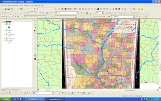
We're pleased to announce new additions to the Rural STEM GIS curriculum collection
1. We've added a new activity on Global Piracy
2. We've ported all of the activities in the collection to MyWorld (so now you can choose ArcMap, AEJEE or MyWorld versions).
Bob Kolvoord and Barbaree Ash Duke
Bob Kolvoord, Ph.D.
Professor, Integrated Science and Technology and
Educational Technologies
Co-Director, STEM Education and Outreach Center
James Madison University
MSC 4102
Harrisonburg, VA 22807
+1 540/568-2752 (o) -2768 (f)
Tuesday, December 08, 2009
Does GIS matter?
If you're reading my blog, you know I think GIS matters and has applications across our lives and classrooms, but this fellow does a nice job saying it. Check out his blog at http://www.vector1media.com/dialogue/perspectives/10372-so-dudedoes-gis-really-matter-anyhowwhy .
Monday, November 23, 2009
Turkey-riffic Maps
In honor of Turkey Day, this link came across one of the GIS lists I receive...
http://www.nwtf.org/for_hunters/all_about_turkeys.html

http://www.nwtf.org/for_hunters/all_about_turkeys.html

Friday, November 20, 2009
Geography: Where Dead Authors and Dusty Books Come to Life
“Why do I need to know this?” How often have you heard that question? Geography is not the first-reach resource for most English Language Arts(ELA) teachers, but I’ve found the use of geospatial technology quite powerful with my students. As one of my 7th graders said, “Everything’s mappable, Mrs. Duke!” How do you teach your students to think? I used geospatial technology cleverly laced among the traditional and required content to bring my ELA class into the 21st Century and get my students thinking!
My first GIS experiment in my classroom was integrating it into The Adventures of Tom Sawyer by Mark Twain. My students did the usual reading and class discussions that you might expect in English class but in addition we looked into other aspects related to the story as well as Twain: banned books, historic timelines, etc. With GIS students investigate Twain’s journey down the Mississippi River as a river boat pilot. Twain believed, “Experience is an author’s most valuable asset.” Taking students on that experience down the river gave them a glimpse into his world and how his characters developed. In addition, students can overlay historic maps from the David Rumsey Collection (www.davidrumsey.com). Now students can look at change over time as the current data layers interface with historic maps. (Lesson available on ArcLessons or my website)
Speaking of change over time, another way to connect students with literature is setting and context of the story. I created an experience for students to appreciate The Watsons Go to Birmingham-1963 by Christopher Paul Curtis

Also, Jerome Berg
Another opportunity to integrate geospatial technology is for research and writing. Students can ask the maps questions and cite their analysis in research projects as well as have more to say in their writings because of proof in the maps. National Atlas Map Maker (www.nationalatlas.gov) offers some great information as well as Social Explorer (www.socialexplorer.com), Nationmaster (www.nationmaster.com) and Statemaster (www.statemaster.com). GIS is great for creative writing as well. My students explored the Ganges River
Since 2000, I’ve been using GIS in the classroom, sharing my experiences with teachers, writing curriculum and conferencing on the benefits of GIS integrated curriculum. Ask yourself, “What’s mappable in my curriculum?” You don’t have to be a geography teacher to realize that you need a little geography in your classroom.
Wednesday, November 18, 2009
GIS Day at St. Paul's

What a great day to introduce GIS to the faculty at Saint Paul's School Covington, LA in Covington , LA
The focus of the presentation was “expanding your borders.” The staff experienced an overview of GIS which included What is GIS?, GIS tools, GIS in the classroom and GIS for School Projects and Community Service. We followed the session with homemade cake made by the event coordinator, Mary Pierson
Monday, November 16, 2009
New My World GIS Versions of our STEM GIS Activities
You can download the activities for AEJEE, ArcGIS or My World GIS. http://www.isat.jmu.edu/stem/curriculum.html
Google Search for Kids
A colleague here in Lousiana passed this along to me today. For those teaching elementary school or want something better for home...check out www.kidrex.org.
Zoomarrific Historic Maps
Happy Geography Week! If you're interested in historic maps, then check this out! http://rumsey.geogarage.com It's an easy to use web map with a selection of David Rumsey's Historical Map Collection on an aerial view of the globe. Once you click on a map point, then you can click again and see the map on the current view of the earth as an overlay. Furthermore, you can play with the transparency of those maps as well. And as my friend Charlie would say, "It's possible with nuttin' but net!" No special software, no special skills, just crank up your web browser, navigate to this page, click and zoom!
Friday, November 13, 2009
Virtually Speaking
I've spent this week with my colleagues, GISetc, at the Region 11 Virtual Technology Conference. It's been a great opportunity to see many speakers in a new venue for me. We did two live presentations and several demo sessions on GIS in Education and GIS tools. Stop by and visit the virtual booth or check out our resources from the conference at http://www.barbareeduke.com/downloads/downloads.htm .
Tuesday, November 10, 2009
GIS = STEM
For folks needing great tools for STEM education, Charlie Fitzpatrick wrote a compelling blog entry at the Education Community for ESRI. Check it out at http://blogs.esri.com/Info/blogs/gisedcom/archive/2009/11/09/fun-with-gis-30-gis-powertool-for-stem.aspx.
Friday, November 06, 2009
Geography Awareness Week
At GeographyAwarenessWeek.org, you can piece together a poster-size map for your bedroom wall or a giant map for your school gymnasium. Take a virtual world tour with Google Earth and watch a video that explains how today’s geospatial revolution is changing everything from shipping to warfare. Test your skills with the Expedition 2 game and a Mystery Location quiz. You can even join 100,000 “map activists” by participating in a blog-a-thon, hosting a Geography Awareness Week event, or signing up for the new GeoMentor program. There’s something for everyone at GeographyAwarenessWeek.org. So get lost in mapping: Find your place in the world!
Thursday, November 05, 2009
Lit Trips and Author's Homes
If you haven't stopped by www.googlelittrips.com lately, then you might need to revisit! For those who are new to this fine resource, Jerome Berg has a collection of journeys that open nicely in Google Earth or ArcGIS Explorer. In addition, they now have 3D models of Author's homes created in Sketch Up and placed where they belong on the globe. If your students' personal borders don't extend beyond their community, then this is an excellent way to take them on a virtual field trip and make literature and authors come alive.
Tuesday, November 03, 2009
Kiwi and Pear Travel the World
Kiwi and Pear are two world traveling monkeys that spread love, friendship and happiness to everyone they meet. The book comes with a world map and stickers for children to interact with the book. Check is out at http://www.kiwiandpear.com/. 

Wednesday, October 14, 2009
Wednesday, October 07, 2009
Easy "Make a Map" GIS
ESRI?s new Make a Map application lets you zoom in on any area of the U.S. and select from 7 different demographic layers. Then you can link to the map you have made or embed it in your own Web page.Enter a location, select a layer, resize the map, and share the map:
http://mapapps.esri.com/create-map/index.html
http://mapapps.esri.com/create-map/index.html
Tuesday, September 29, 2009
Fall is Data Hunting Season
If you're on the hunt for data, there are many resources available where the data is free for educators. Often the challenge is how to search for it efficiently. Like the rest of the globe, I tend to start with a Google search to see what I get. I thought the folks who need simplicity in searching might like the source, GeoCommons.
They have created two tools, Finder! and Maker!. If you go directly to their "finder," you get a simple search field that delivers search results and other possible tags that might relate. For the items I found today, there was a *.kml, a *.csv and a *.shp for each one. I'm not saying this is the only source, but the folks over at GeoCommons have made it nice and clean for us to get data!
Grab your butterfly net and visit them at http://www.geocommons.com for some data!
Wednesday, September 16, 2009
Maps of the Imagination
If you are interested in mapping and the humanities, then Peter Turchi's book Maps of the Imagination: The Writer as Cartographer is a MUST read! He writes, "The purpose of a story or poem, unlike that of a diary, is not to record our experience but to create a context for, and to lead the reader on, a journey."(12) "A map may be beautiful, but if it doesn't tell us what we want to know, or clearly illustrate what is means to tell us, it's merely a decoration. The writer's obligation is to make a rewarding both the reader's journey and his destination. Each completed work is a benchmark, an indication of how far we've come."(22)
Run to the library, warm up your Kindle or place an order...and read!
Run to the library, warm up your Kindle or place an order...and read!
Friday, September 04, 2009
World View from A Different Perspective
If you're not familiar with World Mapper, then you really should check it out. www.worldmapper.org These folks have a cool collection of shape-shifting maps based on the data. For my serious geographer friends, I know that's not the term. :-) For all the teachers out there, you can download the poster versions of each map or the excel data. There are many interesting ways to utilize this data and information!
Sunday, August 23, 2009
Discovery Earth LIVE
This tool from the Discovery Channel is another great way to experience content and geography in a dynamic, timely way. http://dsc.discovery.com/discovery-earth-live/?campaign=dsc-int-hp-p5-el-1#
Friday, August 21, 2009
The Watsons Go to AGX 900
I've designed an ArcGIS Explorer 900 version of my "1963-A Journey North to South" lesson that explores topics inspired by the novel The Watsons Go to Birmingham by Christopher Paul Curtis. You can download from my website at http://www.barbareeduke.com/downloads/downloads.htm and will follow soon on ArcLessons. Additionally, I shared the data on ArcGIS online (http://www.arcgisonline.com). Search "watsons". Happy exploring!
Wednesday, August 19, 2009
Got GIS?
A recent blog post at Computer World magazine interviews Jack Dangermond of ESRI. If you're wondering how GIS applies to you, this gives a good overview. Check it out! http://blogs.computerworld.com/14561/gis_as_game_changer
Tuesday, August 18, 2009
Quote for the Week
"Words are tools which automatically carve convepts out of experience." - Julian Sorrell Huxley
Saturday, August 15, 2009
Mapping Hurricanes
It's that time of year again! One easy way to map and analyze tropical storms and hurricanes is with the National Hurricane Center Data. All maps from the website are available for GIS applications. http://www.nhc.noaa.gov/gis/
Friday, August 14, 2009
New Version of ArcGIS Explorer Available
Check it out! All the details on their blog.
http://blogs.esri.com/Info/blogs/arcgisexplorerblog/archive/2009/08/13/what-s-new-in-arcgis-explorer.aspxWant to go directly to download... http://resources.esri.com/arcgisexplorer/900/index.cfm?fa=download
Happy Mapping!
Tuesday, August 11, 2009
Assessment and Grading Resources
This topic is challenging for every educator. There are some free resources at the Assessment Training Institute Resource Center http://www.assessmentinst.com/resources/resource-center/ along with other places like the STAIRS project http://205.213.162.11/stairs_site/assessment_resources.html and Rubric collections http://www.uwstout.edu/soe/profdev/rubrics.shtml.
Monday, August 10, 2009
Wednesday, August 05, 2009
Geospatial Revolution
I had the priviledge of hearing Fred Hoffman from the Roanoke Governor's School this summer at the National Summit for GIS in K-12 Education at JMU discuss remote sensing. He shared a resource with us from Penn State called the Geospatial Revolution Project. I heard it again at the the ESRI Users Conference this July. The brief video offers compelling reasons to be geospatially aware and made me think about new ways we can be involving our students in geospatial activities intertwined with their curriculum. The slogan alone "The location of anything is becoming everything" makes you think about the impact geospatial skills will have on our future. Have a look at http://geospatialrevolution.psu.edu/. Click on the trailer to view the video.
Friday, July 24, 2009
Go Baylor!
For anyone interested, Baylor has a cool virtual tour online at http://www.baylor.edu/virtualtour/.
Thursday, July 23, 2009
Focusing the Spatial Lens in the Classroom
My good friend and colleague, Dr. Shannon White, has written an article in the latest edition of the ASCD Express. Have a look at "Focusing the Spatial Lens in the Classroom" at http://www.ascd.org/ascd_express/vol4/421_newvoices.aspx
Tuesday, July 21, 2009
Spatial Advertising
Thanks to Dr. Henk Scholten for sharing some great spatial examples in his plenary address to the ESRI Education Users Conference. One that caught my eye was a Dutch ad for coffee. http://strangemaps.wordpress.com/2008/05/26/278-ice-coffee-town-the-netherlands/
You can examine some of his work at EduGIS (www.edugis.nl) and GeoDan (www.gedan.com).
He shared some great perspectives on how GIS affects the development of spatial thinking.
Saturday, July 18, 2009
Cool GIS Gear
Okay...it's time to get your inner GIS geek outfitted in the latest buttons, bottle openers and keychains! My friends over at GISetc have created a fine collection that you can now purchase! Go get 'em at www.gisetc.etsy.com.
New, Free GIS Tools-ArcGIS Explorer 900

Have a look at the latest geo-browser coming from ESRI in August. It updates and enhances the existing ArcGIS Explorer to new heights! I think this tool has some great applications for K-12 education. It goes beyond Google Earth's capabilities so that students can do some more analysis of map data and content. COOL tools are a good think!
http://www.esri.com/events/uc/images/plenary/6arcgis-explorer.html
I'm looking forward to creating some great curricular resources with it! Also check out the other news from the ESRI International User Conference Plenary at http://www.esri.com/events/uc/agenda/plenary.html.
It's always fun learning about new stuff when we make the trek to San Diego each summer! Thanks ESRI!
Thursday, July 16, 2009
San Diego Zoo at the ESRI UC 2009

The famous San Diego Zoo usually has an exhibit at the Map Gallery. This year was no exception. The "visitors" reminded me of home in Louisiana...
he's just a little alligator
Become a GeoMentor

Join the fun and become a GeoMentor! Lots of educators need the expertise and support of a GIS professional while lots of GIS professionals need educators to connect with. Search no more. This is the place to connect. Educators and professionals can register on the GeoMentor site for their needs. It's free and just a good thing to do!
Updates from the ESRI EdUC 2009

Fresh from the ESRI EdUC 2009 and ready to face another year...here are the latest files updated to my website. Downloads for Georeferencing the Curriculum and the Earth, Wind and Fire presentation (sans disco music) are available along with other good resources for integrating GIS in your classroom. http://www.barbareeduke.com/downloads/downloads.htm and http://www.barbareeduke.com/resources/resources.htm
Tuesday, July 07, 2009
Reading, Writing and the Great Outdoors
Bravo to this Wisconsin Teacher! Read about this summer school class where you have to meet your instructor a mile into the state park! This is such a great example of something so many of us can do to make students engaged in learning...even when it's the boring stuff like reading and writing.
http://www.madison.com/wsj/home/sports/outdoors/456943
http://www.madison.com/wsj/home/sports/outdoors/456943
Monday, July 06, 2009
Geocoding Large Data Sets...FREE
Hi all!
While I solidly believe GPS fieldwork is a great thing for a youth based project often I get questions about how can lat/long be created from an address or a spreadsheet. ESRI announced a week or so ago it’s free geocoder and it is great!(http://blogs.esri.com/Info/blogs/gisedcom/archive/2009/06/19/geocoding-using-arcgis-online.aspx)
However, one of the useful tools I would like to share today is the website Batch Geocode - http://www.batchgeocode.com/. It is very beneficial when you have LARGE data sets but equally as useful with a small dataset. You can very quickly copy information from a spreadsheet into this online tool and it will output the information with 2 new fields (bg_lat, bg_long –the bg stands for batchgeocode).
You can create a kmz file for use in Google Earth and you can also import this tabular data into ArcGIS, AEJEE and ArcExplorer with the x, y data!
A few tips that I will share from my experiences with this:
1) Try it out using their “data” that is preloaded before copying your own in. You will see how the process works with a small data set and what all of the fields/options are.
2) At the bottom of the process there is an option to “Save Map to a webpage” this is a webpage created on their website and you have no control over it other than to request it’s removal…which they are very nice to do if you mistakenly put up information that is sensitive (individuals names, phone numbers etc). I learned that the hard way.
3) As the geocoder is processing on the site. Watch your numbers of successfully geocoding data rows especially if you have a large dataset you have entered. The reason I suggest this is that if it slows down and appears to be stalling it is having a problem processing a specific address – if you write down the number that it seems to stall on you will know which row to go to in your spread sheet and look for potential addressing problems. I tried out a 300 person file and had 8 errors that I found this way. Also you can have it process in smaller sections by only copying in/out smaller sections of data at a time.
4) Always check the data once it loads in your GIS program or Google Earth – you may be able to quickly see errors in your information or in the processing. You can always rerun a single line of data. It is free so that doesn’t always mean correct!
I have shared this resource with professionals, youth groups and educators so if you have any questions please don’t hesitate to ask!
Shannon
Shannon H. White, PhD
Geospatial Extension Specialist
Department of Geography
University of Missouri
20 Stewart Hall
Columbia, MO 65211
Phone: (573) 884-0790
http://geospatial.missouri.edu
Friday, July 03, 2009
ASCD 2009 Interview
In March 2009, Dr. Shannon White and I presented at the ASCD Conference in Orlando on using GIS in the Classroom. This posting slipped by me but here it is after the fact...
http://ascd.typepad.com/blog/2009/03/geographic-imaging-systems.html
We'll be together again in San Diego next week for the ESRI Education Users Conference (www.esri.com/educ)...come see us!
http://ascd.typepad.com/blog/2009/03/geographic-imaging-systems.html
We'll be together again in San Diego next week for the ESRI Education Users Conference (www.esri.com/educ)...come see us!
Wednesday, June 24, 2009
Friday, May 29, 2009
Jack Dangermond Speaks on GIS and Web 2.0
This is a nice video of Jack Dangermond, head of ESRI, presenting on the connection between spatial awareness, GIS and the web. Check it out at: http://where.blip.tv/file/2151502/.
I'm always collecting good information to stay current. So often, our educational touchstones need updating. I'm encouraged to see this update on Bloom's. Check out this new article about the updated version of Bloom's Taxonomy: http://techlearning.com/article/8670 .
Friday, May 22, 2009
Friday, May 08, 2009
Wednesday, April 22, 2009
Did you see the morning sky this morning? Venus was just under the waning moon. ( .( )
It was absolutely stunning. The sky was a cobalt blue with just the fringe of a rainbow sunrise
on the horizon.
It would be interesting to combine GPS, GIS, and Astronomy to get different perspectives of celestial events and the reasoning behind the visual based on Lat/Lon and elevation.
It was absolutely stunning. The sky was a cobalt blue with just the fringe of a rainbow sunrise
on the horizon.
It would be interesting to combine GPS, GIS, and Astronomy to get different perspectives of celestial events and the reasoning behind the visual based on Lat/Lon and elevation.
Monday, April 13, 2009
Cross-Curricular Units with GIS

If you're searching for great ways to integrate English Language Arts, Math, Science, Social Studies and GIS lessons, then start with these two examples. Both units include reading, writing and thinking along with solid content-driven examples in all subjects.
- "Water, Water Everywhere"
- "Out of Bounds: A Cross-Curricular Baseball Unit"
Technology Integration in the News
If you're interested in proving how technology integration really affects students, you may want to check out this article, http://www.thejournal.com/articles/24218. It offers some interesting things to consider.
Spring into Nature
As spring ushers in new buds, you might consider getting involved with Project Budburst...fun and educational! Check out their efforts and how you can contribute at http://www.projectbudburst.org!
Sunday, March 15, 2009
ASCD Conference 2009
If you want to see me in person, my colleague Dr. Shannon White and I are presenting tomorrow afternoon, March 16, 2009, at the ASCD Conference. "Engaging Learning Beyond Curriculum Boundaries with GIS" will be presented at 12:30 pm. We'll have great resources and some door prizes! Come join us for the spatial fun!
Wednesday, February 25, 2009
Air Traffic Video
Very fun video that shows 24 hours of world air travel.
http://www.youtube.com/watch?v=o4g930pm8Ms
http://www.youtube.com/watch?v=o4g930pm8Ms
Monday, January 12, 2009
GIS Educator - Winter 2008 edition
Check out my latest article in ESRI's GIS Educator...page 5.
http://www.esri.com/library/newsletters/giseducator/gised-winter08.pdf
http://www.esri.com/library/newsletters/giseducator/gised-winter08.pdf
Subscribe to:
Posts (Atom)