Geocaching isn’t just for science class or the serious geography geek! A cache is simply a hiding place, and caching is hiding something like a treasure. Nature is full of treasures waiting to be explored. A popular movement called “geocaching” gets folks outside with their GPS units to find treasures hidden by other geocachers. If you haven’t tried it yet, it’s great fun! (www.geocaching.com) Folks are geocaching all over the world!
Many educators are taking that idea to the classroom to do campus investigations. Now you might expect that it’s the science teacher out looking at nature, but surprise your students in English Language Arts class with an outdoors writing assignment! Realizing that not all classrooms are created equally, here are some low-tech options as well as the spiffy high-tech ones. Either have students locate specific cached items or let them explore the landscape for surprises. Anyway you do it, get creative and allow the students to explore their creativity.
Low-Tech
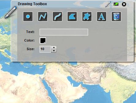
- Create a map of your site with destinations. Use a hand-drawn map with destinations or use a tool like Sketch-A-Map (http://edgis.org/sketch) to create your map for students.
- Students can create a poem or story based on the destinations on the map. Nature is an excellent way to pull more adjectives out of a student. I used a similar activity with my students in my book, Reading, Writing and Thinking around the Globe: Geospatial Technologies for English Language Arts Classroom and Beyond (www.barbareeduke.com) where students create topographic and geographic definitions for words. Visualizing vocabulary can help cement those words into a student’s personal dictionary.
High-Tech
- Using your school’s or a set of loaner GPS units (www.gisetc.com). Set up waypoints with caches. Perhaps the students find words, phrases or starters for writing assignments. They could take photos and return to the classroom with real experiences. Don’t think that you have to have green spaces and trees to make this work. Urban explorations could be quite powerful as well! Perhaps tell the stories of graffiti or buildings changing over time.
- Perhaps you decide to pair the GPS units with cameras (a reason for kids to use those cell phones) to create a photo essay. Just ask National Geographic if photos have a story to tell!
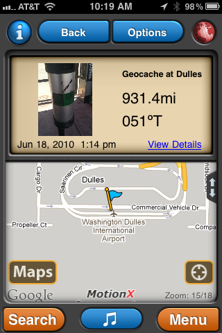
- Another option is to use a smart phone application. I have a GPS app on my iPhone (MotionX GPS) that integrates a picture and text with my waypoint. I can email this waypoint with the photo and text attached, and then view it in a virtual globe application like ArcGIS Explorer (http://www.esri.com/arcgisexplorer) or Google Earth (http://earth.google.com), another educational reason for kids to use that cell phone at school. Because applications like ArcGIS Explorer are equipped with a simple presentation creator, as a next step, you could combine all the stories and photos for a class-wide virtual tour.
- For the more adventurous, you might like to check out a project called “confluencing” (www.confluence.org). This calls for a GPS unit and some planning. Check out some of my adventures with my friend, Dr. Joseph Kerski. (http://www.confluence.org/confluence.php?visitid=14853). The post-adventure writing is the star here. You could take this same approach with your geocaching explorations as well, a detailed story of who, what, where, when, why and how is great practice for all those persuasive writing assignments!
The moral of the story here is: expand the borders of your classroom. Think beyond the text book and computer screen. Engage students with outdoor spatial experiences and watch their writing transform!