Saturday, December 13, 2008

Coastlines Lessons for My World GIS

Great resources, folks!

Science Approach's CoastLines project has posted the My World-based lessons on its NSF-
ITEST sponsored Web site:

Environmental Monitoring
Exploring the Everglades
Invisible Boundaries
Matter of Inches
Monitoring from Afar
Storm Water Pollution

Environmental Monitoring, Invisible Boundaries, and Storm Water Pollution are My World
adaptations of ArcView 3.x lessons developed for the Center for Image Processing in
Education's Mapping an Ocean Sanctuary project. Monitoring from Afar is a My World
adaptation from the NOAA-sponsored Exploring Data with GIS to Experience Sanctuaries
materials. Exploring the Everglades and Matter of Inches were created by the CoastLines
project as training excercises. All are available for download and use by the GIS in
education community at the following URL:

http://www.coastlines.ws/content/view/142/134/

The project has also posted all of its Webinar recordings, warts and all, at the following
URL:

http://www.coastlines.ws/content/category/6/45/131/

A number of these recordings contain My World demonstrations that could be of use to
GIS educators. Note that, because of the resolution of the movies, the files are rather large
and downloads can be time consuming depending upon your connection.

Wednesday, October 22, 2008

Spatial Happenings in Hannibal, NY

Kudos to Bob Jones and all his supporters in Hannibal, NY! They've launched a great effort to integrate spatial thinking into their schools.

Check it out!
http://www.hannibalcsd.org/spatial/ELA.htm

Monday, October 06, 2008

ESRI Education Users Conference 2008 Debriefed

Okay, so it's been a couple of months since our annual trek to San Diego, but here's what I saw this year. Here are my highlights...sorry for the delay!


From the Education Team at the opening Plenary Session:
The Community Atlas Program is still alive and well.
There are some cool things happening with the ESRI Development Center http://www.esri.com/edc
Take note of the addition of ArcLogistics!

The Ed Community site (http://edcommunity.esri.com )has some new things to offer as it grows with the community:
Submit presentations on the calendar area
Request Teacher Education materials
Instructional Videos
Community Profiles

On the Curriculum scene:
4 new books! The Our World Series. Take a look! They're great resources for any age classroom that wants to integrate GIS. http://www.esri.com/publications
Video Tutorials http://webhelp.esri.com
Monthly Webinars

Check out the new benefits of the ArcGIS 9.3 version!

ArcGIS Explorer offers some new goodies too!
transparency
a resource center
bioblitz data
quick menu
KML features
GeoRSS feed

The Keynote from Anne Knowles was fascinating! Her new book, Placing History: How Maps, Spatial Data and GIS Are Changing Historical Scholarship, is available from ESRI Press. It was so refreshing to hear history spotlighted with spatial information. It seems that we have to continue to convince folks involved in the liberals arts that spatial thinking not only has a place in their curriculum and research but is necessary to keep it current and relevant for today's generation of students. She offered some great examples of maps and data. Check out her books!

The THINKING IN 3-D session was a fun exercise in brain theory. We explored and discovered our "favorite brain", or side of the brain while becoming acquainted with the ins and outs of all the elements that make us who we are. "Each brain is an antidote to the overuse of the other." In summation our instructor related these innate tendencies to tackling GIS problems. If you ever have a chance to dissect your personality and brain tendencies, give it a go! It's good to know thyself!

Exploring ArcGIS Analysis Methods and Geoprocessing session offered some great background information on analysis. Highlights for me included: 5 Steps (Formulate a question; Collect, Explore and Pre-process data; Choose analysis tools and methods; Create models to implement analysis; Interpret results and refine methodology) and Working with the Model builder in the tool box.

The GIS Data and Resources session offered some amazing resources. As a curriculum developer, I'm always looking for new data!
Here are a few mentioned:
geodata.gov
gos2.geodata.gov
www.nationalatlas.gov
www.nationalmap.gov
ArcGIS Online


Otherwise, I enjoyed the networking opportunities that these events offer! I reconnected with a colleague from Australia as well as others from around the USA. If you want to get the latest scoop on GIS, consider making the trek to San Diego for the annual ESRI International Users Conference.

Monday, September 29, 2008

New Collection of GIS Lessons

We're happy to announce the publication of the Rural STEM GIS activity collection for AEJEE and ArcGIS. This collection of 12 activities (authored by Barbaree Ash Duke, edited by me and classroom tested by teachers around the country) focuses on middle school science and social studies. Each activity comes with student instructions and worksheet, teacher notes, an answer key and all relevant data. The activities are referenced to relevant national standards. Each activity can also be easily modified for younger or older students. Each activity can be used by itself or in conjunction with one or more of the other activities. We hope teachers in a variety of settings will find these activities of use.

All the activities can be accessed at http://www.isat.jmu.edu/stem/curriculum.html 

We've categorized the activities into three groups by GIS experience:

Level 1 – suitable as a first-time GIS experience
Bats in the Neighborhood: Friend or Foe?
Hunting for the Best Cabela's Location
Invasive Species: Attack of the Animals
Invasive Species: Attack of the Plants


Level 2 – best after a prior introduction to GIS
We are the World: A Look at Demographics
Production and Consumption: The Give and Take of Energy
Disaster Strikes
Should You Drink the Water?
Watersheds: Why bother?


Level 3 – best after more than one experience with GIS
What's Your Carbon Footprint?
Can You Grow Money?
Survivor: The Agricultural Challenge


This work is supported the Center for Rural STEM Education at James Madison University and funded by the U.S. Department of Education.

Please feel free to contact us with comments and questions.

Bob Kolvoord

Bob Kolvoord, Ph.D.
Professor, Integrated Science and Technology and
Educational Technologies
Co-Director, JMU Center for STEM Education and Outreach
James Madison University
MSC 4102
Harrisonburg, VA 22807

+1 540/568-2752 (o) -2768 (f)
kolvoora@jmu.edu

Tuesday, September 16, 2008

A Dozen Reasons to Use GIS in Your Classroom

They're ready!  The National Center for Rural STEM Education Outreach-Geospatial Technology has drafted, tested, edited and posted.  The lessons as well as a wealth of resources and curricular materials are ready for download.  Check out the site: http://www.isat.jmu.edu/stem/curriculum.html 

GIS lessons are waiting for you!

Tuesday, September 09, 2008

Translating Joined Data Files from ArcMap 9.x to AEJEE

In my curriculum writing for GIS, I often join data files for use in ArcMap 9.x.  AEJEE, ArcExplorer Java Edition for Education, is unhappy with these files.  However, there are some simple steps to follow so that they work nicely in AEJEE.  

FIRST, In ArcMap:
1. Join the data files
2. fix the table names so that they are only 8 characters max
3. get rid of any spare fields that you really don't need
4. save your edits
5. export the data as a shapefile

THEN, In AEJEE:
1. add the shapefile
2. do your analysis

Special Thanks to Charlie Fitzpatrick and all the Education Team folks at ESRI for making GIS easier for all educators.

Thursday, July 31, 2008

Sunday, July 06, 2008

Create Your Own Earth Story with Earth Live

Check out Discovery's Earth Live.
You can view other stories or create your own original with their interactive online tools.
http://dsc.discovery.com/guides/discovery-earth-live/discovery-earth-live.html


Thursday, June 12, 2008

Confluencing

Now that summer's upon us, you might be interested in grabbing your GPS unit and doing some exploring. Get the scoop at http://www.confluence.org!

As my friend Joseph says, "Get out there and explore the world!"

Spatial News

My friend, Dr. Joseph Kerski, and some fine Nebraska teachers made the news!
They had coverage at KNOP based on the hour or so that a TV reporter spent with them at the GIS workshop: http://www.knopnews2.com/

There is a spatial thinking link above, today. Not sure how long it will be active but this might work into the future:

http://www.knopnews2.com/modules/news/article.php?storyid=2625&source=2

Then click on “Watch Video”.

Monday, March 24, 2008

National Summit on Geospatial Technologies in K-12 Education

The National Center for Rural STEM Education will be hosting a National Summit on Geospatial Technologies in K-12 Education at James Madison University in Harrisonburg, VA from 11 to 12 July 2008. This gathering will provide an opportunity for developers and teachers to share materials and approaches, for school districts to learn about the possibilities for GIS in the classroom, for researchers to connect to practioners, and for the GIS in Education community to get together and plan for the future. It will feature sessions dedicated to successful uses of these technologies in classrooms and opportunities to discuss the challenges of broadening the reach to more students.
A draft conference agenda and a call for presentations are available at http://www.isat.jmu.edu/stem/workshop.html
Presentation proposals are due by 18 April 2008 (decisions will be made by the end of April).
Travel support is available for a number of teachers from rural school districts. The conference fee ($50 - includes all meals) is very low and we want to encourage broad participation.
Please contact Bob Kolvoord (kolvoora@jmu.edu) with any questions.
Please feel free to share this with other lists to which you contribute.
Bob Kolvoord, Ph.D.
Professor, Integrated Science and Technology and Educational Technologies James Madison University MSC 4102 Harrisonburg, VA 22807
+1 540/568-2752 (o) -2768 (f)
kolvoora@jmu.edu

GIS Student Contest

Thought the GIS edu folks might be interested...


GeoWeb 2008 Conference - 1st Student ContestGeoWeb is the industry leading event focused on GIS and the Internet

Do you have what it takes to develop a piece of software or a solution to a theoretical problem to win our student contest?

If you do, then we want to hear from you, as this student contest open to all full-time students attending an educational institution anywhere in the world.

Students may submit a registration of an abstract of their proposal at any time (see http://geowebconference.org/students-academia/contest-information). Note that both registration and final submissions are due and must be submitted no later than May 15, 2008.
Develop software or solve a theoretical problem to:
Generate 3D models for Google Earth, Virtual Earth etc. from CAD drawings automatically.
To enhance position measurement inside a building.
Integrate Google or Virtual Earth with Second Life.
Generalize from large scale to small scale in 2D and 3D.
Generate GML (observations) from KML and KML (by styling) from GML.
Validate geography and topology automatically using a rule based mechanism.
To visualize the content of an ebRIM (OASIS) registry.
Develop visualization mechanisms for travelogues
Use wavlets to integrate geometry, coverages and observations.
Students may submit a registration of an abstract of their proposal at any time (see http://geowebconference.org/students-academia/contest-information). Note that both registration and final submissions are due and must be submitted no later than May 15, 2008.

Software submissions must include the following components:
One sentence description of your software.
Source code for the software (C, C++, Java etc).
Build files as required to create an executable program for one of (Linux, Windows XP/Vista, Mac OS). The build file must be executable automatically and generate an executable program with minimal input by the software judges. It should require very minimal effort on the part of the installer to create an executable program.Description of the functionality of the software.
This description should be limited to two typed pages (12 pt type), and must highlight the key points that you feel the software demonstrates that are advances over existing software technology.
Presentation (e.g. Keynote, Power Point etc) that you will give if your entry is selected.
Contest Submittals
Students must register at www.geowebconference.org by May 15th, 2008.

Contest Requirements
Contest entrants will be required to complete a registration form verifying their status as full time students and these details will be verified before any award is granted.

Costs
Please note that any costs associated with the submittal for this contest is at the expense of the student.

Selection Process
The selection of the contest winner(s) will be made by a GeoWeb committee consisting of leading figures in the GIS industry and will be notified by June 6th, 2008.

Prizes
Winners of the contest will be brought to the GeoWeb 2008 conference in Vancouver, Canada, and all legitimate expenses* will be paid by the contest supporters. A cash honorarium will also be provided.

*The contest supporters will arrange transportation to/from Vancouver, lodging and meals while in Vancouver, however reserve the right to refuse any expenses they believe are unreasonable.

Complete information on the student contest and conference may be obtained at www.geowebconference.org.

Tuesday, March 18, 2008

Thursday, February 28, 2008

Cool Stuff to do with Google Maps

http://geography.about.com/b/2008/02/25/100-things-to-do-with-google-maps-mashups.htm

GeoTech 2008-day 1

I'm at GeoTech 2008 this week in Dallas, TX! We had a great day of pre-conference workshops today. I enjoyed hearing Bob Coulter of the Missouri Botanical Garden talk about Historic GIS Data. Bob did a great job talking us through downloading and incorporating the downloaded files into our own GIS projects.
http://www.nhgis.org/

I worked with a great group of folks in the afternoon session exploring Literature Latitudes.

I'm looking forward to another great day tomorrow!

Wednesday, February 06, 2008

Activity Testers Needed for Rural STEM Project

GIS in Education Community
The National Center for Rural STEM Education at James Madison University is looking for activity testers for a new set of GIS activities written for AEJEE and ArcGIS 9. The lessons are written for middle school students, but we would be interested in testers at all primary and secondary school grades.
We'll offer a $100 stipend for teachers to classroom test and comment on two of the lessons in the collection. You'll need to do the lessons with your students, fill out an evaluation form and send in a couple of examples of student work. If you'd like to be involved in this, please send Barbaree Ash Duke (baduke@mindspring.com) the following information by 20 Feb.:
Name
School
Size of School (students and urban/suburban/rural)
Location
Grade Level/Subject Taught
Number of Students
List of activities you're willing to test**
**Choose 3 activities from our collection (we'll try to give you 2 from your choices, but we want to make sure we can get them all tested). The collection is as follows (more info is available at http://www.isat.jmu.edu/stem/curriculum.html):
Cabela's Activity - Revised 26 July 2007
In this activity, students use GIS to find the ideal location for a new Cabela's outdoor gear store in Virginia.
World Demographics - Revised 26 July 2007
In this activity, students use GIS to explore the economies and standards of living of countries across the world.
Disasters - revised 23 July 2007
In this activity, students use GIS to explore the impact of natural disasters, including hurricanes, tornadoes, earthquakes, etc. on their local area. They also explore which health care facilities are important in the case of disaster.
Energy - revised 23 July 2007
In this activity, students use GIS to explore the production and consumption of energy by countries around the world. By comparing energy use of different types, students explore energy sustainability. Both the AEJEE and ArcMap versions are included in the zip file below.
Drinking Water Activity - Posted 26 July 2007
In this activity, students use GIS to explore the source and quality of drinking water in their community by investigating local aquifers. They'll use the concentration of Arsenic and EPA-listed toxic discharge sites to help them compare the quality of their water with drinking water across the U.S.
Watersheds - Revised 26 July 2007
In this activity, students use GIS to explore their watershed and how that watershed relates to other watersheds. This is a good follow-on to the water quality activity above.
Carbon Footprint - Revised 2 September 2007
In this activity, students use GIS to explore the concept of carbon footprint and the its relationship to the population and size of different countries. It is part of the Environment series of activities.

Bats in the Neighborhood - New 14 October 2007
In this activity, students use GIS to explore the habitats of bats in their state or region and compare/contrast the different species of bats. It is part of the Environment series of activities.
Survivor Agriculture - New 28 November 2007
In this activity, students use GIS to explore the agriculture productivity of their state and determine if it could support the state's population in the wake of a large-scale disaster. Students also compare and contrast their state with neighboring states. It is part of the Environment series of activities.
Farm Economics - New 15 January 2008
In this activity, students use GIS to explore the agriculture economics of their state and county and discover where high sales farms are located across the U.S. The students also construct a plan for creating a viable farm locally. It is part of the Environment series of activities.
Invasive Species: Plants - available by 15 Feb. 2008
In this activity, students use GIS to explore the impact of invasive plant species on their local area. They also explore what their state and community can do to prevent further damage.
Invasive Species: Animals - available by 15 Feb. 2008
In this activity, students use GIS to explore the impact of invasive animal species on their local area. They also explore what their state and community can do to prevent further damage.
Testing can start soon (though the Invasive Species activity won't be available until Feb.). Testing must be completed by the end of April.
Stipend checks will be sent when you've returned the evaluation paperwork to Barbaree Ash Duke. We only have 30 testing slots available, so if you're interested, please let us know soon. Thanks for considering this request.
Bob Kolvoord
Bob Kolvoord, Ph.D.
Professor, Integrated Science and Technology and
Educational Technologies
James Madison University
MSC 4102
Harrisonburg, VA 22807
+1 540/568-2752 (o) -2768 (f)
kolvoora@jmu.edu
ASCD Conference - New Orleans, LA

Want to talk curriculum and GIS in Education with a friendly face?

If anyone is attending the ASCD conference and would like to chat, please let me know. I'm not presenting but will be there...since it's in my backyard. My friends from ESRI will be in the Exhibit Hall also.

If you're attending, zap me an email and we'll plan to have a chat!

Barbaree
baduke@mindspring.com

Wednesday, January 30, 2008

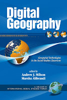
New Book, Digital Geography-Geospatial Technologies in the Social Studies Classroom


Digital Geography - Geospatial Technologies in the Social Studies Classroom
Edited by:Andrew J. Milson, University of North Texas and
Marsha Alibrandi, Fairfield University

You can order directly from the publisher at http://www.infoagepub.com/products/content/p473c94ace3ef3.php Alternatively, it is also available on Amazon.com at http://www.amazon.com/Digital-Geography-Geo-spatial-Technologies-International/dp/1593116721/ref=sr_1_1?ie=UTF8&s=books&qid=1201640376&sr=8-1

Thursday, January 24, 2008

Great Spatial Thinking Article

My friend, Dr. Joseph Kerski, has penned a nice article on spatial thinking in the latest issue of ArcWatch from ESRI. This issue has come to the forefront in recent years, but I believe is at the core of education, regardless of the subject. We need to create communities of thinkers. Thinking happens for students when they see connections and purpose in their world. Have a look at Joseph's article and send along comments for discussion.

http://www.esri.com/news/arcwatch/0108/spatial-thinking.html

Well done Joseph!


Wednesday, January 23, 2008

New Design, New Lessons Available, Next Conference

NEW DESIGN
My website has adopted a new design. I hope you find it helpful. I'll be added RSS feeds and other features soon.
http://www.barbareeduke.com/

NEW LESSONS...go get 'em!
My work with the good folks at JMU is available at http://www.isat.jmu.edu/stem/curriculum.html. The latest lessons use the 2002 agricultural census data: "Survivor: The Agricultural Challenge" and "Can You Grow Money?" Coming soon: Invasions: Attack of the Plants and Attack of the Animals!

NEXT CONFERENCE...come see me!
I'll be in Dallas, TX at the end of February at GeoTech 2008. http://www.bdhs.org/geotech I'll be talking about updates in Literature Latitudes and utilizing geospatial technology in English Language Arts classes.